blah blah blah
Five Finger Point
Length: 3.3 miles out-and-back with loopDifficulty (click for info): Beginner
Elevation Gain: 210 feet (+200 feet on return)
Rating (click for info): 6/10
Driving Directions:
Trailhead and parking area are on Pinehurst Road in Holderness, NH. From Rt. 113, 5.0 miles northeast of Rt. 3 in Holderness and 6.7 miles west of Rt. 109 in Sandwich, turn east onto dirt Pinehurst Road. Drive 0.9 miles, and after passing some camp buildings, turn right onto one of the camp roads and immediately pull into the parking area on the left. The trail begins on the opposite side of Pinehurst Road, just a bit further up. You'll see multiple signs indicating not to park on the road around the lot. Click here for a Google map.
About the Hike:
Notice: The trails described here are among a set of trails maintained by the Squam Lakes Association which are closed annually for mud season. The trails remain closed for at least a month starting from snowmelt.
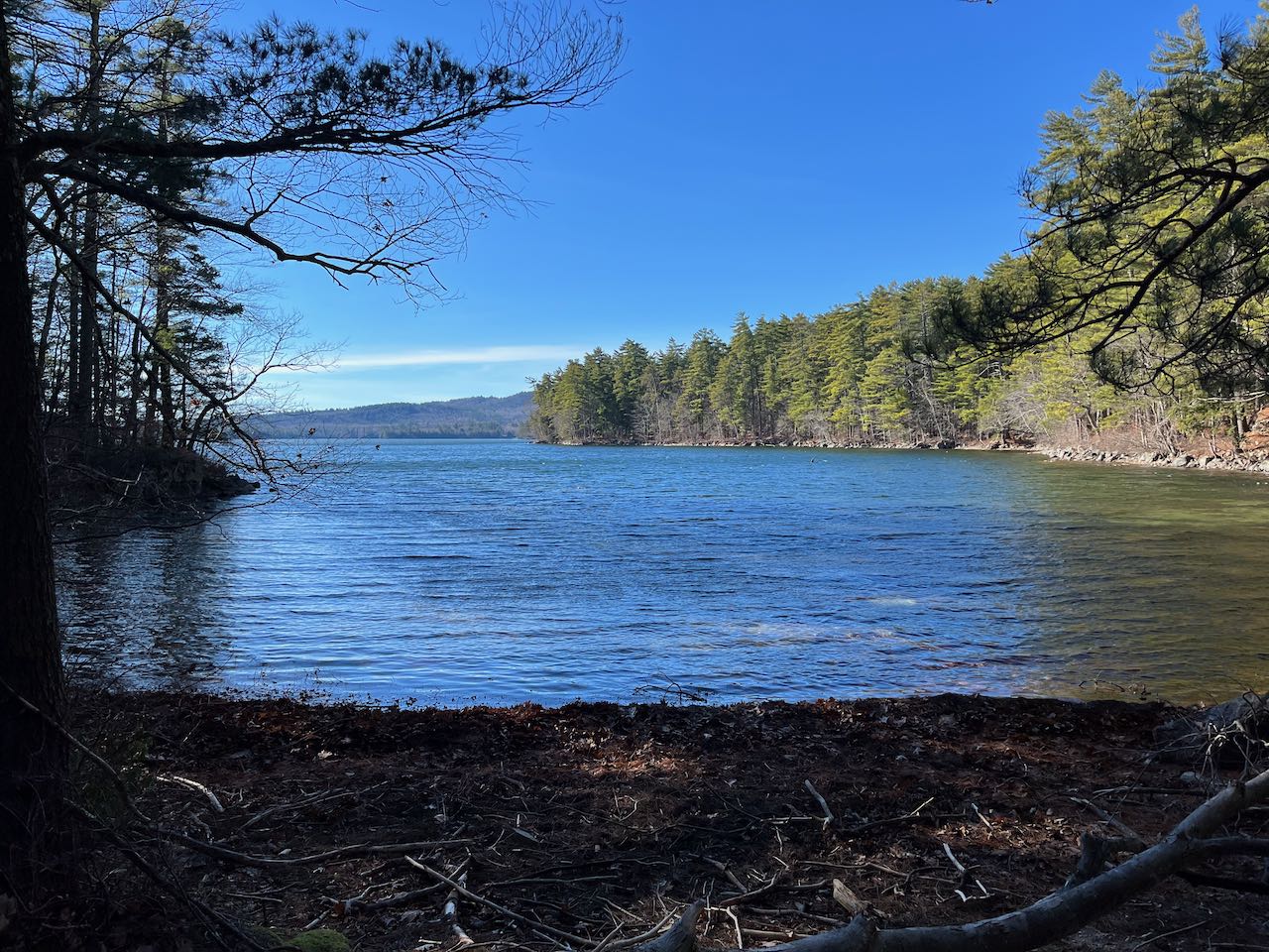
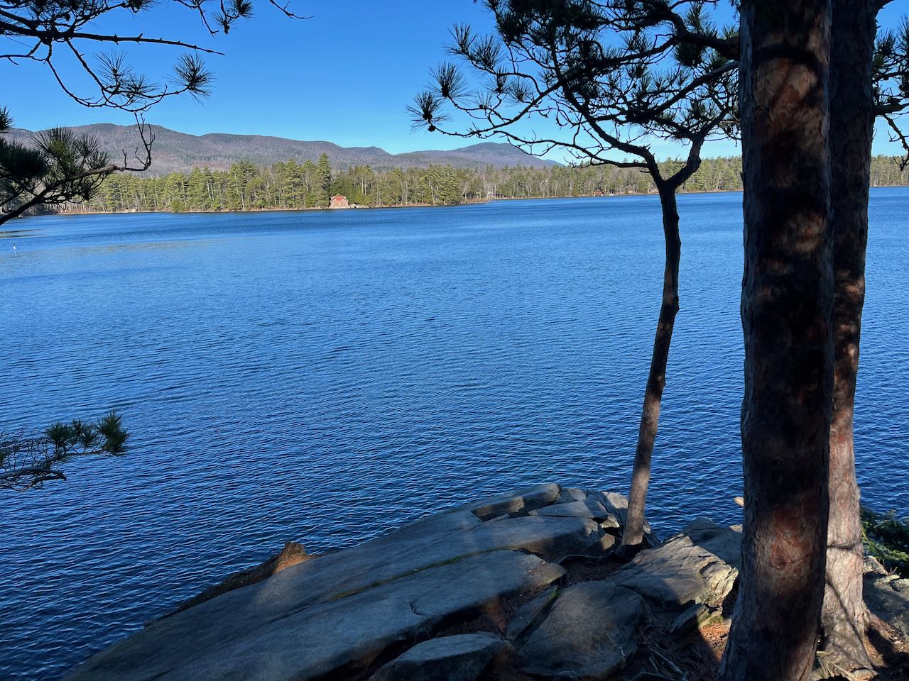
The major waterbodies of New Hampshire's Lakes Region are irregularly shaped, with innumerable projections, coves, and jagged islands. Five Finger Point is the name of one such peninsula which shows off this characteristic of Squam Lake. As its name suggests, the landmass is punctuated with five notable smaller peninsulas protruding from the main one. While most of Squam Lake's shoreline is dotted with lakehouses and strung together with roads, Five Finger Point is covered by conservation land and offers a scenic walking trail around its edge, visiting picturesque rocky outcrops, sandy beaches, and bushy wetlands.
The trail begins around a lakeside camp. Cross the road you drove in on and follow the path signed to "all trails" underneath power lines for a short distance. Then, cross a dirt drive and walk around either side of a barn to cross into the woods onto Pasture Trail. Walk gently uphill to a trail junction after 0.2 miles, where trails diverge left to head up to the Rattlesnake Mountains. Bear right at both signs (60 feet apart) onto Five Finger Point Trail. The path heads out across the rocky hillside, undulating as it goes. After half a mile, the trail swings to the right and begins to descend. It leads along a stone wall, passing beneath the power lines again and around the end of the private extension to Pinehurst Road. After 0.2 miles, you cross the peninsula's narrow neck and arrive at a sign where the loop splits.
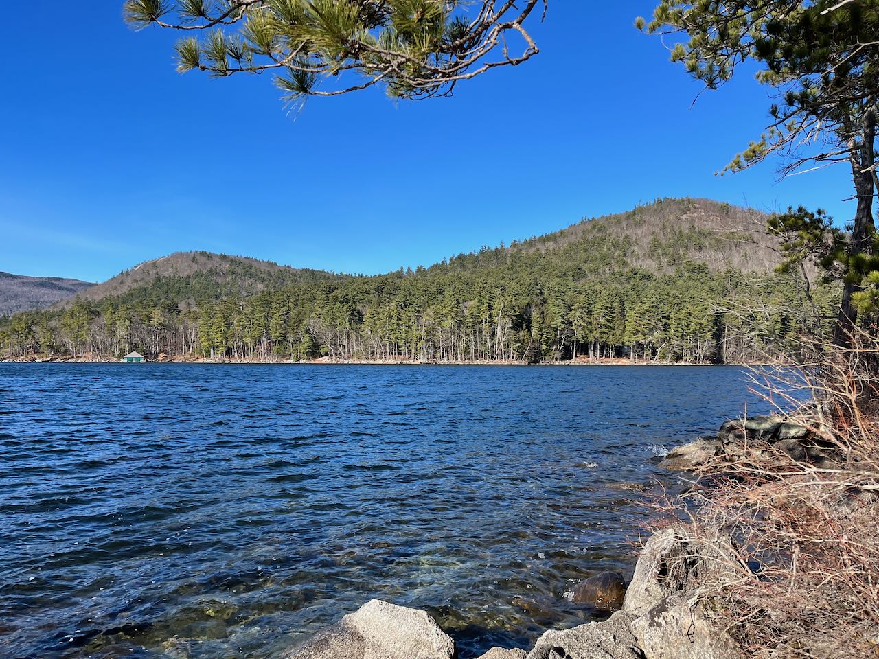
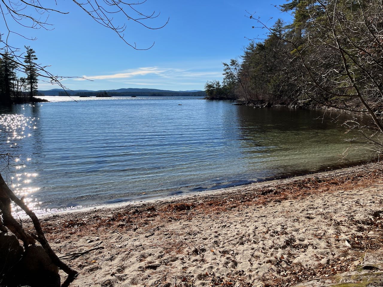
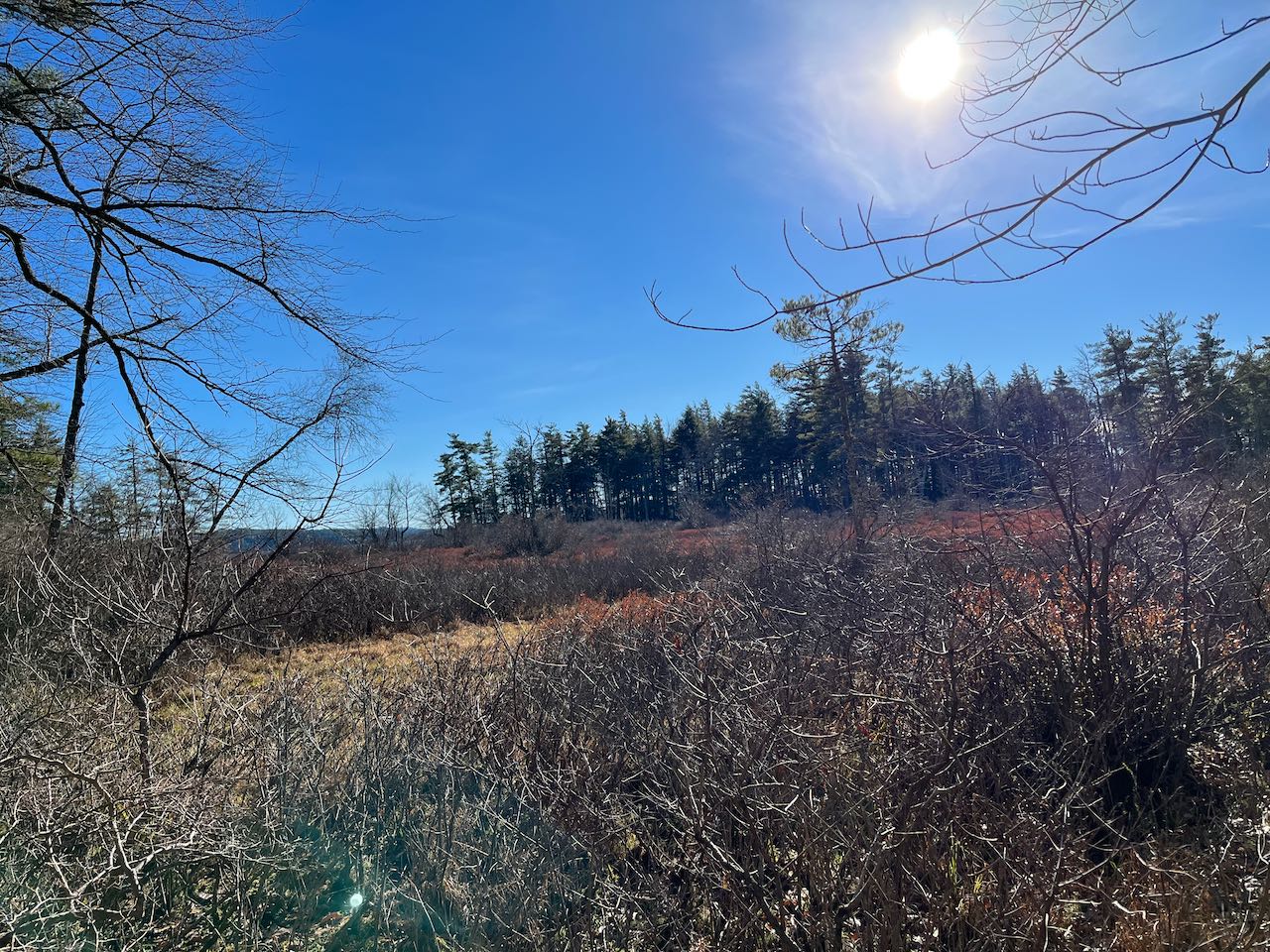
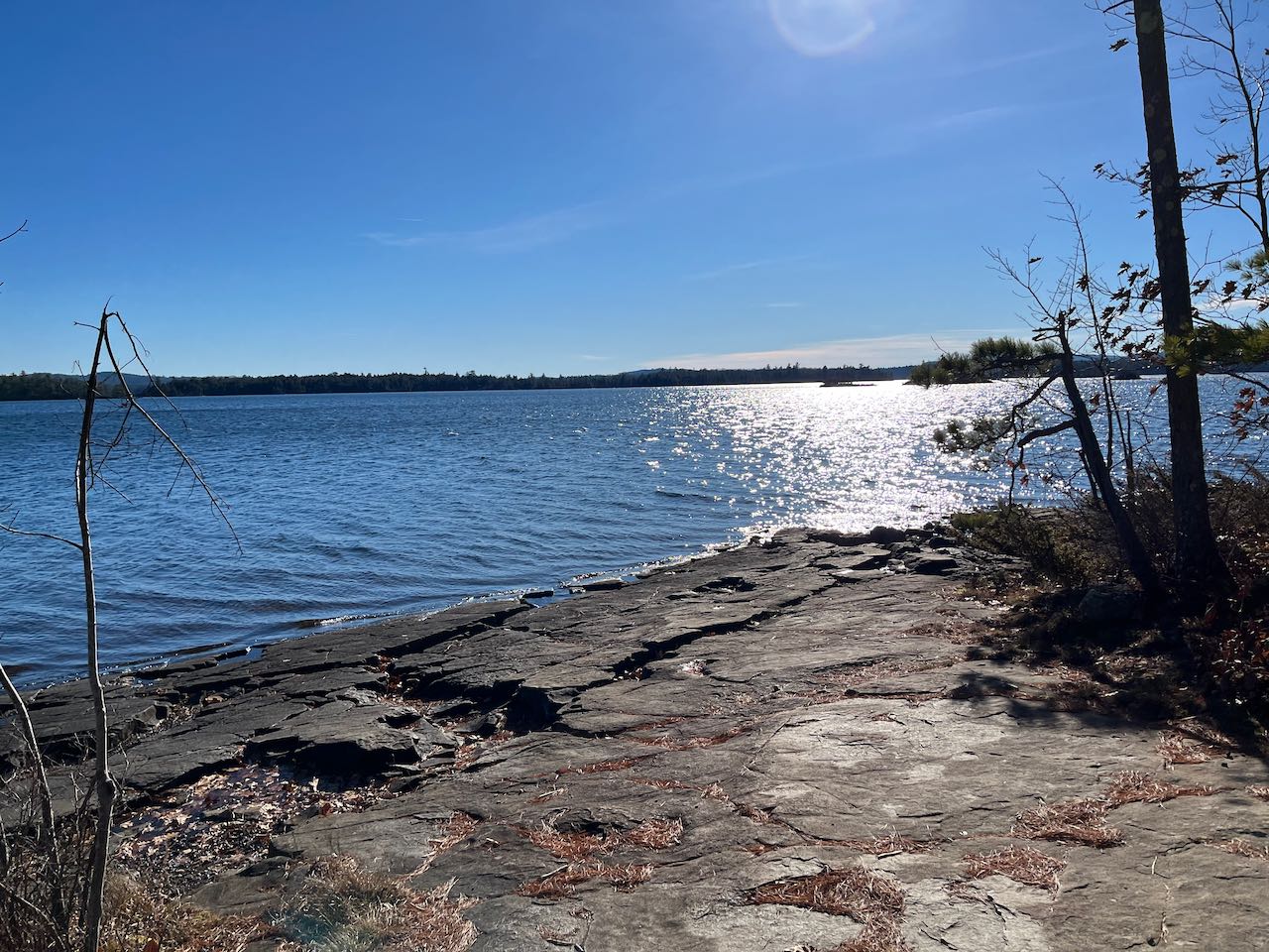
Taking the right fork first, you pass by an opening on the shoreline where you can look out the narrow True Cove. The path leads close to the water, through low bushes and sparse pine trees. After 0.1 miles, the trail passes a rocky outcrop where you can glance back over the cove at East Rattlesnake Mountain. Continuing on a very straight course along the west edge of the peninsula, look for a short side path on the right leading down to a rocky place on the water after 0.3 miles. Straight ahead, a narrow strip of land juts out from the end of the first "finger". Looking back over True Cove, you can now see both Rattlesnake Mountains. Just 0.05 miles, further, on the main trail, arrive at a T-junction. To the left, the loop continues around, while the path to the right leads 200 feet out to a sunny slab of bedrock dipping into the water at the very tip of the first finger. Around a large wooden sign directed toward boaters approaching the rocks, you have a beautiful view across the waters. Straight out is a cluster of islets called Otter Island. The second finger protrudes into your view to the left. After soaking in the scenery here, continue on the main trail as it wraps around the little bay for 0.1 miles to the far end, where you can look back out toward the lake from a tiny, secluded beach. The trail shortcuts the second finger, crossing through the woods and reaching a slightly larger beach on the other side after 0.2 miles. Continue through the interior of the point, and after another 0.1 miles, you will approach a boggy area on your right that is slowly filling in and attaching a sixth finger that once was an island. Having passed by the third finger and now passing by the fourth, the trail skirts the edge of the water again and reaches a junction with a side path on the right after 0.1 miles. This short path takes you 200 feet to a tall ledge at the end of the smallest fifth point. The smooth rock careening into the water and the red pines clinging to it create an evocative atmosphere as you gaze across Rattlesnake Cove, the east side of Five Finger Point. Over some of the lakehouses, you can see the eastern end of the Squam Range, along with Mt. Israel. Across a narrow strait in front of you is the small side of Hoag Island. To the right you can look out to the main lake. Back on the main trail, leave the lakeside for the final time. The path takes you through some boulders and ferns, then arrives back at the loop junction after 0.3 miles. You can now return the way you came.
Printable directions page